


Nation puts geospatial data system on the map
Space Daily
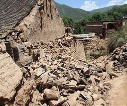
China has established a national emergency geospatial data system to provide first-responders with detailed maps within two hours after a disaster, a senior official said.
Get Started for FREE
Sign up with Facebook Sign up with X
I don't have a Facebook or a X account


 Your new post is loading...
 Your new post is loading...
Your new post is loading...
Nation puts geospatial data system on the map 
No comment yet.
Sign up to comment

NJVC will leverage the Cloudcuity AppDeployer application PaaS to integrate various apps to support the needs of a diverse population of international disaster first responders (e.g., law enforcement, fire response, disaster medical response) into a common complex humanitarian disaster (CHD) management operating environment.
Phillip Trotter's insight:
In this implementation, the AppDeployer PaaS extends and complements the Google Maps Engine development PaaS platform. Google will provide massively scalable, critical geospatial data and mapping services to the demonstration participants. The Cloud-based Google Maps Engine product lets users create, share, publish and view (via a browser or Google Earth client) purpose-built maps to address key CHD mission requirements. Clickon the title or image to learn more.

Only with sustained investment in innovation can countries improve the most fundamental quality-of-life indicators for their citizens. For complex and vital disciplines like disaster management, this requires comprehensive collaboration across community, government, industry and academia and on a global scale. By focusing on common social goals – such as reducing and mitigating the impact of natural and man-made disasters – best practices and collective technical knowledge can be used to help improve community resilience and potentially save lives.
Peter Csermely is a Hungarian biochemist, and professor at Semmelweis University (Budapest, Hungary). His major fields of study are molecular chaperones and networks. In 1995, Csermely launched a highly successful initiative, which provided research opportunities for more than 10,000 gifted high school students. In 2006 he established the Hungarian National Talent Support Council, and in 2010 he started a nationwide movement for bettering the everyday work morality in Hungary.
Via Complexity Digest
|

Google Inc launched an open data platform yesterday to share information on natural disasters in Taiwan such as typhoons and floods, with the aim of building the country into a model area for the cloud computing-based system.
Phillip Trotter's insight:
Google has been responding to natural disasters since Hurricane Katrina in 2005 by making information such as storm paths, shelter locations, emergency numbers, and donation opportunities easily accessible. Its great to see them extending these services.
Phillip Trotter's insight:
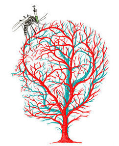
StanMed is always worth reading and the Standford Medicine Summer 2013 Special Report is an awesome collection of articles. Crossing Paths with disease bearing pests is a great article on disease mapping and modeling using malaria as an illustrative example for guiding effective health policy. However with articles on debugging dhaka's water, citezin scientists and neighbourhood health, learning lessons from Hurrican Sandy, interview with matt Damon and Gary White about their Water.org work the rest of the issue is worth looking at too.

The disruptions to everything from gasoline supplies to the deliveries of merchandise for the holiday shopping season caused by Hurricane Sandy have demonstrated that our ability to forecast weather events has outpaced our ability to forecast supply-chain disasters. If we can forecast a superstorm, we should be able to predict events that could disrupt supply chains and mitigate their impact. To do that, all the parties that have a stake in disruptions — members of supply chains, insurers, governments, and markets — should proactively develop a responsiveness system that would be able to predict different types and levels of supply-chain disasters. Depending on the type and level, different response plans would get activated. Click on the image or title to learn more.
How might radioactive substances spread from the nation's 16 nuclear power plants should they be hit by serious accidents? The Nuclear Regulation Authority on Wednesday released maps based on its diffusion simulation results. The government has refrained from conducting this kind of simulation on its own for fear of heightening anxiety among residents around the plants. However, it is surely necessary to simulate worst-case scenarios in the course of preparing disaster management measures. Local governments around these facilities have to compile disaster management plans by March next year. They should refer to the new data as they make steady efforts on those plans. The NRA regards its simulations only as rough estimates because geographical features were not taken into account and the data did not reflect the constantly changing direction of the wind. Click on the title to learn more..
|


Accurate maps and geospatial data is critical to success of first responders in disaster zones. Good to see China establishing a national system to support first responders.