Human Interest
198.8K views | +0 today
Follow
Human Interest
Your new post is loading...
Rescooped by Skuuppilehdet from Geogrpahy - Spatial Science - Geographic Information Systems
Scoop.it!

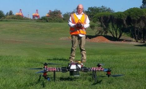
It’s here: 3D surveying in real-time with UAV-based LiDAR

It’s here: 3D surveying in real-time with UAV-based LiDAR | Human Interest | Scoop.it
Australia’s UNSW and Linke & Linke Surveys develop drone LiDAR platform.

Via Neil Bombardier
Neil Bombardier's curator insight, June 14, 2017 5:56 AM

This is HUGE realtime 3D surveying with massive spatial resolution from UAV's is a real game changer

Scooped by Skuuppilehdet
Scoop.it!

Aerial Urbex: 7 Difficult Deserted Places Filmed with Drones

Aerial Urbex: 7 Difficult Deserted Places Filmed with Drones | Human Interest | Scoop.it
Drones have changed the landscape of urban exploration and building infiltration, allowing their navigators access to toxic, irradiated, forbidden and structurally unsound places. These haunting vi...
No comment yet.