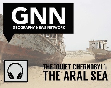
"Prior to the 1960’s, the Aral Sea was the fourth largest lake and approximately the size of Ireland. Fed by both the Amu Darya and Syr Darya rivers carrying snowmelt from the mountains to the southeast, the Aral Sea moderated the climate and provided a robust fishing industry that straddled the present-day border between Kazakhstan and Uzbekistan. For the map savvy, that Aral Sea would be almost unrecognizable—it has long appeared as two basins known as the North and the South Aral Sea since the rivers were diverted for crops, leading to the Aral Sea’s alarming shrinkage. Recent NASA satellite imagery shows the decline that the Aral Sea has undergone since 2000, leaving the South Aral Sea completely dried up in 2014. "
Tags: podcast, Maps 101, historical, environment, Central Asia, environment modify, Aral Sea.
Via
Mike Busarello's Digital Storybooks


 Your new post is loading...