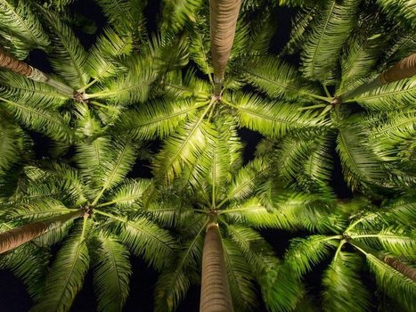
"A new census that shows that Earth is host to a staggering 3.02 trillion trees — more than scientists expected.The most recent estimate only counted 400 billion trees, reports Rachel Ehrenberg. Because prior studies used satellite technology alone instead of including data from on-the-ground tree density studies, writes Ehrenberg, they missed the mark. They also estimate that since human civilization began, 45.8 percent of all trees been lost."
Get Started for FREE
Sign up with Facebook Sign up with X
I don't have a Facebook or a X account
 Your new post is loading... Your new post is loading...
 Your new post is loading... Your new post is loading...

Savannah Rains's curator insight,
May 27, 2015 1:51 AM
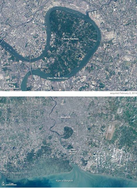
This scoop shows an example of built environmental space. The highly urban and crowded Thailand has little green space. So why is this massive green park looking landmass there? Its a strictly environmental section of land to help water flow into the ocean. The people call it the "green lung" because its plants give off oxygen and provide a contrast from its urban sprawl. This article shows the importance that should be placed on having more strictly environmental places in big cities. 
Chris Costa's curator insight,
November 9, 2015 2:06 PM
It's interesting to see the mixture of natural and manmade landscapes in this image. Humans have an enormous influence on the world around us- we have moved entire rivers for our own purposes, reshaped entire regions. In China, we have literally made it rain. Therefore, it's nice to see remnants of the rich environments that used to cover the urban sprawls of many of the world's largest cities, like Central Park in New York. Bang Kachao in Bangkok is another example of this, a reminder of the richness of the region before it was overwhelmed by the urban development that has characterized Bangkok over the previous century. The oasis serves as a valuable tourist attraction, as Westerners come to enjoy the bike trails and small farming community within Thailand's green lung. Leave it to hipsters to travel halfway across the globe just to enjoy nature within the confines of one of the world's largest cities.
brielle blais's curator insight,
May 3, 2018 3:55 PM
This showcases how important physical geography is. This "green lung" breaks up the high urbanized Bangkok. This helps the environment thrive and helps to cut down of emissions that affect climate change which is a problem in some areas.
|

Danielle Lip's curator insight,
April 22, 2015 9:16 PM
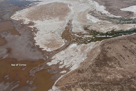
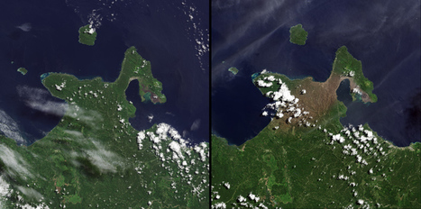
There may not be may words on this article but a picture can speak a thousands words as I've seen when looking at these pictures. The climate changing is not only affecting the way people live but it is also affecting the structure of the world's atmosphere such as the melting glacier in Peru called Qori Kalis. The ice and glacier has retreated so much that the ice has melted and created a small lake right in the middle where the huge glacier used to stand. What is going to happen to the work if these type of disasters keep occurring? What other types of physical changes will occur? Any type of change in the land can affect how people live, how they find shelter and any other aspect of living. These type of physical changes are not only happening far from the United States but also in the United States such as California. It is important to look at these 302 photos because it really put life into perspective, showing how something can easily change over time. |


Censo de árboles está en 3.02 trillones de arboles
Suena como mucho, pero con en realidad son pocos para tanta gente.