Human Interest
199.1K views | +3 today
Follow
Human Interest
Your new post is loading...
Rescooped by Skuuppilehdet from Mr Hill's Geography
Scoop.it!

Is This What The World Will Look Like In Hundreds Of Years?

Is This What The World Will Look Like In Hundreds Of Years? | Human Interest | Scoop.it
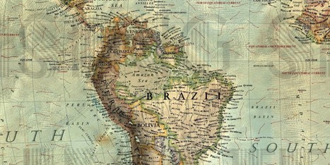
Imagine a scenic cruise through the Amazon Sea, or a week at a seaside resort in Arkansas. Fanciful ideas in the early 21st century, these dramatic changes could become a reality in the very distant future.

Global sea levels have risen about eight...

Via mrhill
No comment yet.
Scooped by Skuuppilehdet
Scoop.it!

The Real Pirates of the Caribbean

The Real Pirates of the Caribbean | Human Interest | Scoop.it
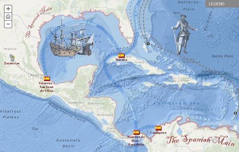
Explore the travels and exploits of five real pirates of the Caribbean. Click through the tabs to track the adventures of each pirate overlaid on Spanish ports and pirate strongholds in the area. Zoom into the map to see additional detail.
Jared Medeiros's curator insight, February 11, 2015 10:00 PM

This pirate excursion map is so cool and gives a great look at the travels of different pirates.  As we get farther away from these time periods, it seems like the idea of these Caribbean pirates are fictional.  To hear true historical events about these individual pirates is very interesting.  I would  love to take a time machine back to Port Royal during these times to experience that madness.

Brian Wilk's curator insight, March 28, 2015 9:34 AM

Imagine the horror a native of the Caribbean must have felt when white men came into their scenic lands and pillaged their villages and plundered their treasuries? Blackbeard otherwise known as Edward Teach, would light slow burning cannon fuses and place them in his beard to create an aura about him as he fought and raided these port of call. Calico Jack Rackham, a great pirate name if there ever was one, was best known for having  a pair of female pirates aboard. Instantly becomes one of my heroes! Then you have William Parker who was actually an opportunist backed by England who plundered Spanish treasures throughout Central America. Here is my favorite pirate joke; what is a pirate's favorite letter? "R" you say? No, it's the letter "C", pirates love the sea....

Dr. Helen Teague's curator insight, September 14, 2015 9:28 AM

very interesting interactive map

Scooped by Skuuppilehdet
Scoop.it!

Urban Exploration

Urban Exploration | Human Interest | Scoop.it

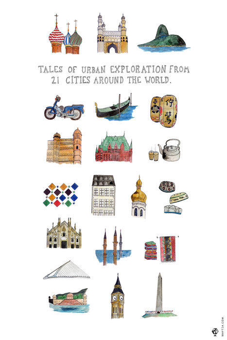
"The French have a wonderful word—flâneur—for someone who seeks to explore and understand the nature of a city’s landscape, usually by taking spontaneous adventures amidst the ebb and flow of life going on around them. In this week’s theme we invite you to lose yourself reading about the flâneur-esque adventures of Maptia’s streetwise connoisseurs and explore a myriad of cities through their eyes."

Tony Aguilar's curator insight, December 1, 2013 12:29 AM

This article demonstrates that there are so many places around the world yet to visit and it is important to plan and save as soon as possible becuase seeing all the beautiful cities of the world ma ytake several years, so preperation in is a must, From Cities in Asia, to Paris, London, Russia and Turkey you will be able to travel on festive dates and examine the landscapes that define these beautiful metropolises. From Cathedrals, to Big Ben, and Haggia Sophia in Instanbul, one will be marveled by the multicutural beauty and night life that exists around the world

Helen Rowling's curator insight, December 1, 2013 8:18 PM

Gr8 immersion of stories of lives in other countries.

Tony Gough's curator insight, December 9, 2013 6:09 AM

Travel the world and read the short stories to learn more!

Rescooped by Skuuppilehdet from AP HUMAN GEOGRAPHY DIGITAL STUDY: MIKE BUSARELLO
Scoop.it!

Latitude and Longitude of a Point

Latitude and Longitude of a Point | Human Interest | Scoop.it
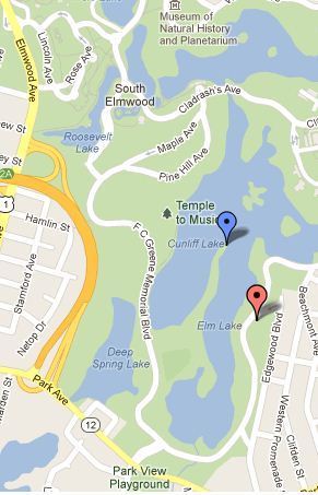
Find the latitude and longitude of a point using Google Maps.


Simple, straightforward and easy to use.  All you do is point and click on the map to get latitude and longitude in both decimal degrees and DMS (degrees, minutes and seconds).  You can also quickly enter coordinates in either format an have the location displayed on the map.


Tags: GPS, mapping, location.


Via Seth Dixon, Mr. David Burton, Mike Busarello's Digital Storybooks
No comment yet.
Scooped by Skuuppilehdet
Scoop.it!

The Science behind Google Earth

The Science behind Google Earth | Human Interest | Scoop.it

"Google is using a new technology to automatically generate  3D buildings from 45-degree angle aerial photography made by overlapping passes of aircraft.  The aerial photos are combined to create 3D models."

Annenkov's curator insight, April 16, 2014 12:46 AM

This technology of visualization I would name "3D landscape"

Mirta Liliana Filgueira's curator insight, April 16, 2014 8:40 PM

Tecnología para generar imágenes en 3D con Google Earth

Sid McIntyre-DeLaMelena's curator insight, May 29, 2014 2:06 PM

Google Earth has made the Earth easier to decipher and examine in a geographical sense of location and place by being able to see multiple layers. This article goes into the 3D designs and usage of aerial photography to create 3D images.

Scooped by Skuuppilehdet
Scoop.it!

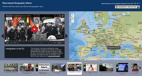
Place-based Geography Videos

Place-based Geography Videos | Human Interest | Scoop.it

Professor Seth Dixon shares over 50 of his favorite geography videos in this online map http://bit.ly/KDY6C2

Melissa Marie Falco-Dargitz's curator insight, November 3, 2014 12:02 PM

It was nice to see where everything was happening. I hope it gets updated to more current events. I wish we had something like this when we were looking at the invasion of Kuwait.

Caroline Ivy's curator insight, March 15, 2015 5:19 PM

Seth Dixon uses ArgGIS to juxtapose maps with the location a video is associated with. 


This idea has crossed my mind before. Now, a video can be contemplated with the spatial accuracy needed. This connects events to a place, and can help students more fully grasp the geospatial distribution of events. 

Nita Ardi's curator insight, January 14, 2019 12:16 PM
Great resource for classroom and information to get kids going. 
Rescooped by Skuuppilehdet from Mr Hill's Geography
Scoop.it!

Spatial Navigation Before GPS

Spatial Navigation Before GPS | Human Interest | Scoop.it

"Giant 70-foot concrete arrows that point your way across the country, left behind by a forgotten age of US mail delivery.  Long before the days of radio (and those convenient little smartphone applications), the US Postal service began a cross-country air mail service using army war surplus planes from World War I.  The federal government funded enormous concrete arrows to be built every 10 miles or so along established airmail routes they were each built alongside a 50 foot tall tower with a rotating gas-powered light. These airway beacons are said to have been visible from a distance of 10 miles high."


Via mrhill
Giovanni Sonego's curator insight, December 15, 2013 1:49 PM

Adesso sembra incredibile che si usasse un sistema simile per guidare la posta aerea. Forse a quei tempi sembrava normale. 

Steven Flis's curator insight, December 16, 2013 3:14 AM

I love articles like this one where they talk about the collide of different times. This article speaks of huge concrete arrows which were left from 1930's air mail routes. sadly most of the towers that were paired with the arrows have been dismantled but still really cool that these directional arrows from the past can still be found almost 90 years later.

Elle Reagan's curator insight, September 28, 2014 11:44 PM

Wow technology has come a long way in just a short amount of time! We would still be using  those stone arrows if it wasn't for the invention of the GPS.